Here's Why Headlines Around 'Hurricane' Ophelia Are Misleading You
If there's one thing other than the imminent invasion of spiders that gives everyone in the media a reason to splurge dramatic headlines across their publications it's the weather.
Weather teases are part and parcel of both newspaper and website culture these days - hell we're kind of even doing it now - so when the word 'hurricane' pops into the conversation everyone loses their shit.
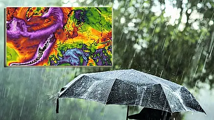
'Dramatic satellite footage shows how Hurricane Ophelia is heading straight for Ireland,' 'Hurricane Ophelia 'has strengthened' as it tracks towards Ireland,' and 'Hurricane Ophelia update: TERRIFYING eyewall gathers in Atlantic as storm heads towards UK' are just some of the headlines that are doing the rounds over the last few days.
The thing is that while it may be classed as hurricane at its present location half way across the Atlantic Ocean, by the time Ophelia actually comes into contact with Ireland or the UK, it won't be. Now don't get me wrong, it can still bring extreme wind and rain but given Met Éireann are not able to accurately predict the strength of the storm or indeed whether it will actually hit Ireland yet, headline writers need to calm the feck down.
In the wake of the media reports this week, met.ie have posted an update on their website about the possibility of Ophelia hitting ground in Ireland:
There has been some media coverage that hurricane Ophelia will impact Ireland to some degree at the start of next week. At this stage, there is strong evidence from the weather forecast models that its remnants will track close to or even over parts of Ireland, but at present, there are still a wide spread of possible outcomes. Our forecasters are treating the situation with caution and are in contact with our international colleagues, but given the lead time and the inherent uncertainties that come with the modelling of a tropical system it won’t be possible to quantify the exact timing, nor the strength or intensity of the wind and rain, in any great detail until later in the weekend.
They add, 'Ophelia won’t be a hurricane in meteorological terms when it reaches our part of the world as she will have moved over the cooler waters of the mid-Atlantic and undergone what is known as extra-tropical transition.'
So while there could be the threat of wind gusts reaching hurricane force or indeed heavy rainfall with this system, it means the traditional attributes of a hurricane – such as an eye or an eye-wall containing a core of hurricane force winds - are very unlikely to be present. Instead, it will likely engage and merge with a frontal zone in the Atlantic, morphing into a mid-latitude depression with tropical characteristics.
Again, one doesn't want to pretend everything will definitely be grand but when reading coverage of terrifying dramatic weather on its way to Ireland it's always best to rely on the experts for information rather than over the top hurricanebait headlines.